Nam Phú Yên EZ: The driving force for southern central coast
VGP – The Nam Phú Yên Economic Zone, covering 20,730 ha and having modern urban infrastructure, will function as the driving force for the southern central coast and a gateway to the open sea for Việt Nam’s Central Highlands, Southern Laos, Northeast Cambodia, and Thailand.
The PM just ratified the
overall planning scheme (to 2025) for the Nam Phú Yên Economic Zone in the
southern central
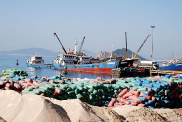
The EZ consists of a
non-tariff (320 ha) and a tariff areas. There are also several major functional
quarters, including a seaport (470 ha), industrial zones (2,682 ha), urban
quarters (4,065 ha), tourism and eco-tourism zones (740 ha), and green areas (1,706
ha).
The PM’s decision also
clearly defines orientations for transport development, power and water
supplies, environmental hygiene, and communications there.
The Phú Yên Provincial
People’s Committee is assigned to make public the planning scheme and put it
into reality.
By Hoàng Uyên